Via Augusta Penedès
Via Augusta Penedès
The landscape of
Via Augusta Penedès
Live it!
The landscape of
Via Augusta Penedès
Live it!
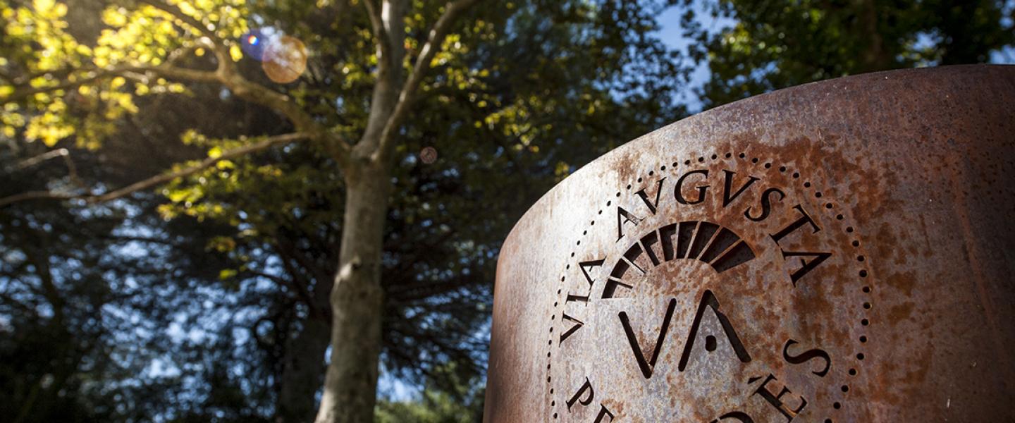
Via Augusta
a walk with over 2,000 years of history

The paths and trails of the Penedès put us in intimate contact with the territory.
The route includes MTB and gravel bike routes.

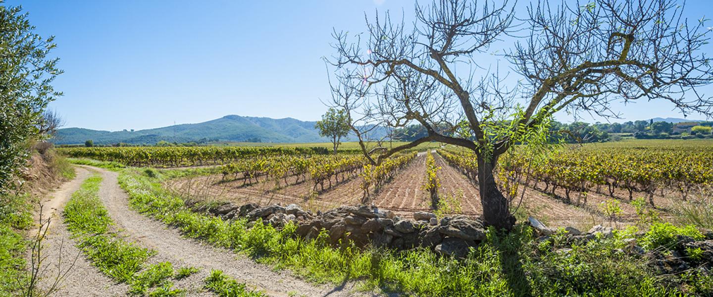
The combination of vineyards and history make the Penedès landscape unique.

The traces of the past and how the territory has been transformed explain where we come from and where we have got to. .
What is the Via Augusta Penedès?

The Via Augusta was one of the longest roads built during Roman times. It linked Rome with Cadiz along the entire Mediterranean coast, following the route of an ancient Iberian pathway. It was fitted out as a Roman road by the Roman legionaries themselves in the 2nd century BC.
Its layout most probably corresponds to that of current roads such as the AP-7 or the N-340, but its influence goes beyond that. This is demonstrated by the fact that numerous Roman sites are concentrated around it. The remains of villas, farms and markets, from which tiles, amphorae and ceramics have been found. Remains of civil architecture have also been found, such as bridges, dams, lime kilns, silos and other remains of Roman settlements.
This important road, which connected cities on the Mediterranean coast, in turn encouraged the appearance of inns and stops where draught animals could be fed and chariots could be repaired, contributing to its consolidation as one of the most important Roman roads.
More than two thousand years later, a route has been created that covers the places where the Via Augusta passed through the Penedès. This is a unique landscape, a wine-growing mosaic made up of small rural villages, castles, watchtowers, farmhouses and wineries. The route takes advantage of the dense network of backroads, paths and farm tracks, and crosses the vast expanses of vineyards of the Penedès, approaching numerous points of cultural and historical interest, both from Roman times and later periods.
Route and stages

The route, which runs from Gelida to Bellvei, comes in seven stages 6-14 kilometres long. They range from easy to moderate difficulty and can be done in either direction, east or west. You can choose some variations on the route. The route is designed to be done on foot, mountain or gravel bike. It runs mainly on paved roads, dirt tracks and the occasional single track without too much difficulty.
There are two alternatives to the main route, one goes around Vilafranca del Penedès via Les Cabanyes and Pacs del Penedès to Santa Margarida i els Monjos, and the other reaches Vilafranca from Lavern-Subirats via Sant Sebastià dels Gorgs, Sant Cugat Sesgarrigues and Sant Pere Molanta. The individual stages always start, and end, at a train station.
From Santa Margarida i els Monjos, the route continues south through Castellet and La Gornal until it reaches Bellvei, the end of the route.

Technical sheet
Technical sheet
Distance: 51.25 km (without connections to train stations).
Distance by the eastern variant: 54 km and 620m+.
Distance by the western variant: 53 km and 560 m+.
Highest point: 271 m.
Lowest point: 77 m.
Walking time: 12 hours, 20 min.
Cycling time: 4 hours, 30 min.
Difficulty: the difficulty of each stage ranges from easy to moderate.
- Complete gpx track for hiking and MTB.
- Complete gpx track for hiking and MTB (eastern variant).
- Complete gpx track for hiking and MTB (western variant).
- Complete gpx track for gravel bikes.
- Complete gpx track for gravel biles (eastern variant).
- Complete gpx track for gravel biles (western variant).
- Discover all the stages.
The Via Augusta Penedès Project
The Penedès, land of vineyards,
land of discoveries
Although vines have been grown in the Penedès for almost 2,700 years, it was not until the 18th century that the crop became dominant in the region. This dominance has resisted even the modernisation of the country: the growth of population centres, industry and the roads that cross the Penedès have not substantially changed its agricultural character, with the vine as the dominant element of the landscape. This landscape is the setting for a wide range of unique routes, on foot, by car or by bicycle, which allow visitors to discover a territory full of history and enjoy its nooks and crannies and secrets.
